Dr Guy Paxman will deliver the ESE Departmental Seminar on Thursday the 7th of March 2024: Constraining the extent of the Greenland Ice Sheet during past warmer climates: insights from the subglacial landscape”
Join us in room G41 – RSM Building – on Thursday 7th of March 2024 at 12h15.
Abstract
Loss of ice from Greenland is one of the largest contributors to global sea level rise in the 21st Century. To help inform global policy decisions, an overarching objective of the glaciological community is to develop numerical models of ice-sheet behaviour that are capable of robustly projecting the future evolution of the Greenland Ice Sheet in a warming world. To evaluate these models, we can use geological records to constrain how the Greenland Ice Sheet behaved during past warmer climates that act as analogues for projected future warming. However, the long-term history of the Greenland Ice Sheet remains widely debated and poorly understood. A potentially valuable archive is the landscape covered by the ice sheet itself, which contains geomorphological records that can provide insights into past ice behaviour. Subglacial topography is mapped using ice-penetrating radar surveys and can also be inferred from ice-surface satellite imagery. As of 2024, almost one million line-km of radar data have been acquired across Greenland, but the potential of these data
remains largely untapped.
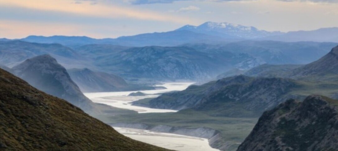
In this talk I will outline the systematic mapping of ice-covered valleys across Greenland using ice surface morphology and ice-penetrating radar data. I will describe automated workflows used to identify and quantify valley morphology and the use of random forest models to classify valleys according to their morphological similarity to those formed by glacial or fluvial incision elsewhere in the Northern Hemisphere. This analysis reveals intricate valley networks in the subglacial highlands of eastern and southern Greenland that exhibit morphologies indicative of substantial glacial modification of an inherited fluvial landscape. However, these valleys are situated beneath slow-moving, frozen (i.e., non-erosive) ice, so were not incised beneath the modern ice sheet. The geomorphological mapping is integrated with simple ice-sheet modelling experiments to infer that these valleys were incised during the warmer climates of the late Miocene and/or late Pliocene, prior to the growth of a continental-scale ice sheet. At this time in Greenland’s glacial history, ice was restricted to the southern and eastern highlands and Greenland contained less than 10% of its modern ice volume, with barystatic sea level ~7 metres higher as a result. The geometry of the valleys provides valuable new constraints on the configuration, extent, and dynamics of these early ice masses, which can in turn be used to improve our understanding of climate and the cryosphere in a warmer-than-present world.
About the speaker
Guy is a glacial geophysicist and geomorphologist interested in subglacial landscapes, geology, and Earth structure in the polar regions, particularly Greenland and Antarctica. His research focuses on the interactions between solid Earth processes, topography, and ice sheet dynamics, with the goal of understanding more about the behaviour of past, present and future ice sheets in warmer climates. This involves combined analysis of large geophysical and geological datasets, including radar-derived ice thickness and bed topography, gravity and magnetic anomalies, bedrock geology, crustal and lithospheric properties, offshore sediment records, and satellite remote sensing, alongside
numerical modelling and machine learning techniques.
The focus of his Ph.D. was the reconstruction of palaeotopography in Antarctica over multi-million year time scales, and the impacts of landscape evolution on past ice sheet behaviour and stability. Since then, he has have worked on a US National Science Foundation (NSF) funded project to predict coastal responses to a changing Greenland Ice Sheet. This included constraining past ice sheet extent and behaviour from geomorphological analysis of subglacial landscapes in the Greenlandic interior, improving models of solid Earth deformation across a range of timescales (i.e. elastic and viscous responses to ice sheet (un)loading), and developing projections of relative sea level and bathymetric change around the Greenland coastline in response to future warming scenarios.
His current research as an Assistant Professor at Durham aims to develop a series of automated methods of mapping and classifying subglacial geomorphological features in Antarctica and Greenland. Use of machine learning techniques will facilitate the analysis of large and hitherto under-utilised airborne geophysical datasets (e.g., radar, gravity, and magnetics) and help better understand the subglacial environment. The
project also aims to combine landscape classification with dated offshore sediment records that constrain the timing and location of episodes of landscape modification. The overarching aim is to link landscape features to the process(es) responsible for their formation, and in turn better understand ice sheet extent and behaviour during past warmer climate intervals.