


Typhoon Gaemi IRIS attribution analysis
Typhoon Gaemi’s extreme winds increased 50% by climate change
Typhoon Gaemi was a destructive Category 4 West Pacific typhoon. It rapidly intensified before reaching Taiwan in a first approach. It was then stalled by the high mountains tracked southwards then looped back before making final landfall in the North on the 25th July 2024. It then continued its path westward to make another landfall in Fujian Province, China. The stalling of the landfall will have added to the damage in Taiwan by creating more accumulated rainfall and sustained wind speed for longer.The potential intensity is a key metric that estimates the maximum possible wind speed, and this has increased (Figure 1). Using IRIS, thousands of typhoons close to Taiwan were simulated (Figure 2). We can calculate a range of possible intensities in a pre-industrial colder world. The next simulation is done for the same cases but for the current climate.
The intensity of a Gaemi type event, at the first approach, was increased by about 4 m/s or 7% (Figure 3). From this we can also determine that the likelihood of this type of event near Taiwan has changed from an event expected on average about once every 4 years to once every 3 years (Figure 3). Typhoons reaching Taiwan like Gaemi have become about 50% more likely due to human-caused climate change.
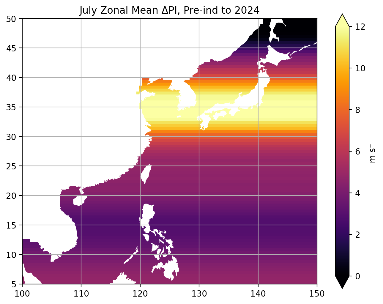 |
Figure 1 - Estimated zonally-averaged change in July potential intensity from pre-industrial to present day expressed in terms of typhoon sustained maximum wind speed. |
|---|---|
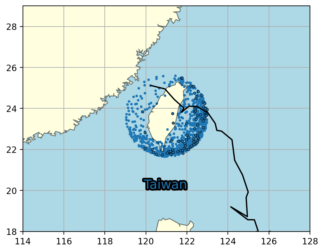 |
Figure 2 - Events contributing to the attribution analysis. Black circles show the location of the maximum intensity of tracks of observed typhoons in the vicinity of Taiwan. Blue dots show the same for a sample of tracks simulated by IRIS. The black line shows the observed path of Typhoon Gaemi. |
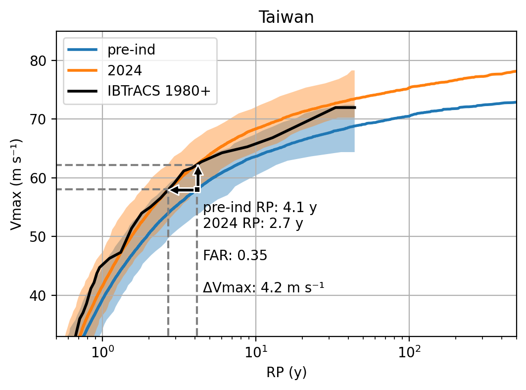 |
Figure 3 - Return curves for hurricanes passing close to Taiwan. IRIS pre-industrial and present-day simulations shown in blue and orange respectively, observations are in black (1980-2023). The shading shows range of sampling uncertainty of 44-year samples of IRIS simulations. |