LBRG

The Landscapes and Basins Research Group is a multidisciplinary team of geoscientists advancing understanding of how climate and tectonics shape the Earth’s surface. Our research tackles pressing, societally relevant challenges—from geohazards and climate change to long-term energy security.
We draw on a powerful combination of fundamental and applied approaches across geology, geophysics, data science, and AI. Our group is distinguished by its integration of complementary methods, including Earth observation, geological and geomorphic fieldwork, numerical modelling, subsurface data interpretation, and basin analysis.
Through this interdisciplinary framework, we generate transformative insights into complex Earth processes to inform sustainable, science-based solutions to the challenges facing society.
Research Areas:
Our research integrates structural geology, tectonic geomorphology, seismic data analysis, data science and AI methods to understand active tectonics. In particular, we focus on how faults initiate, evolve, and slip through time. We draw on observations across a wide range of spatial and temporal scales, from characterizing individual faults and short-term ground motions using satellite data to investigating the evolution of continental rift systems over millions of years. By advancing our understanding of the continuity of active fault systems and fault slip behaviour, our work contributes to seismic hazard assessment in regions of active faulting.
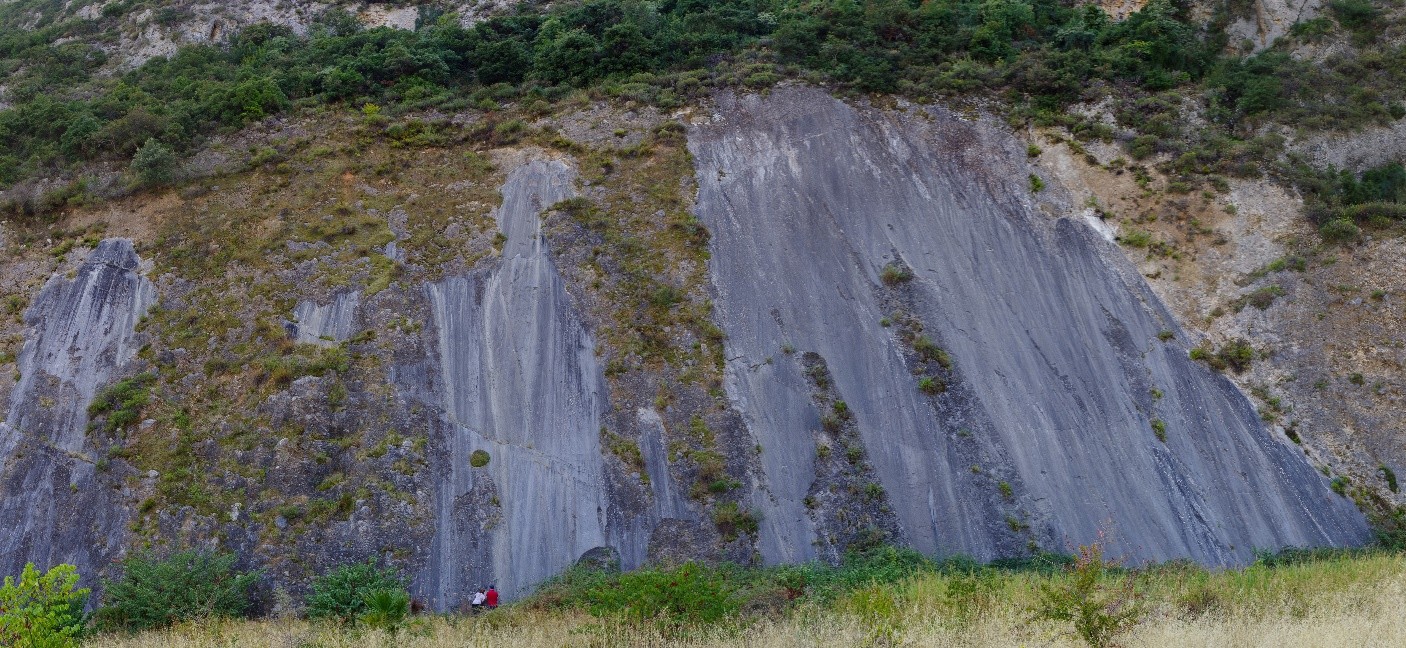
Identifying faults such as this and estimating the rate at which they move is vital to understand geohazards from earthquakes
Our research aims to quantify how sediment, water and nutrients are transported and stored across the surface of the Earth’s. We seek to decipher the evolving dynamics of rivers, deltas and deep-sea environments and their response to changing climate and tectonics. In particular we focus on:
1, The response of fluvial systems to climate and tectonic changes through time, and their expression in the stratigraphic record;
2, Deep-water sedimentary processes, and interactions with anthropogenic activities;
3, Source to sink systems and global dynamics of sediment transport.
We use a range of techniques to tackle these problems including field-based data collection from modern and ancient systems, numerical modelling, interpretation of subsurface data and remote sensing techniques.
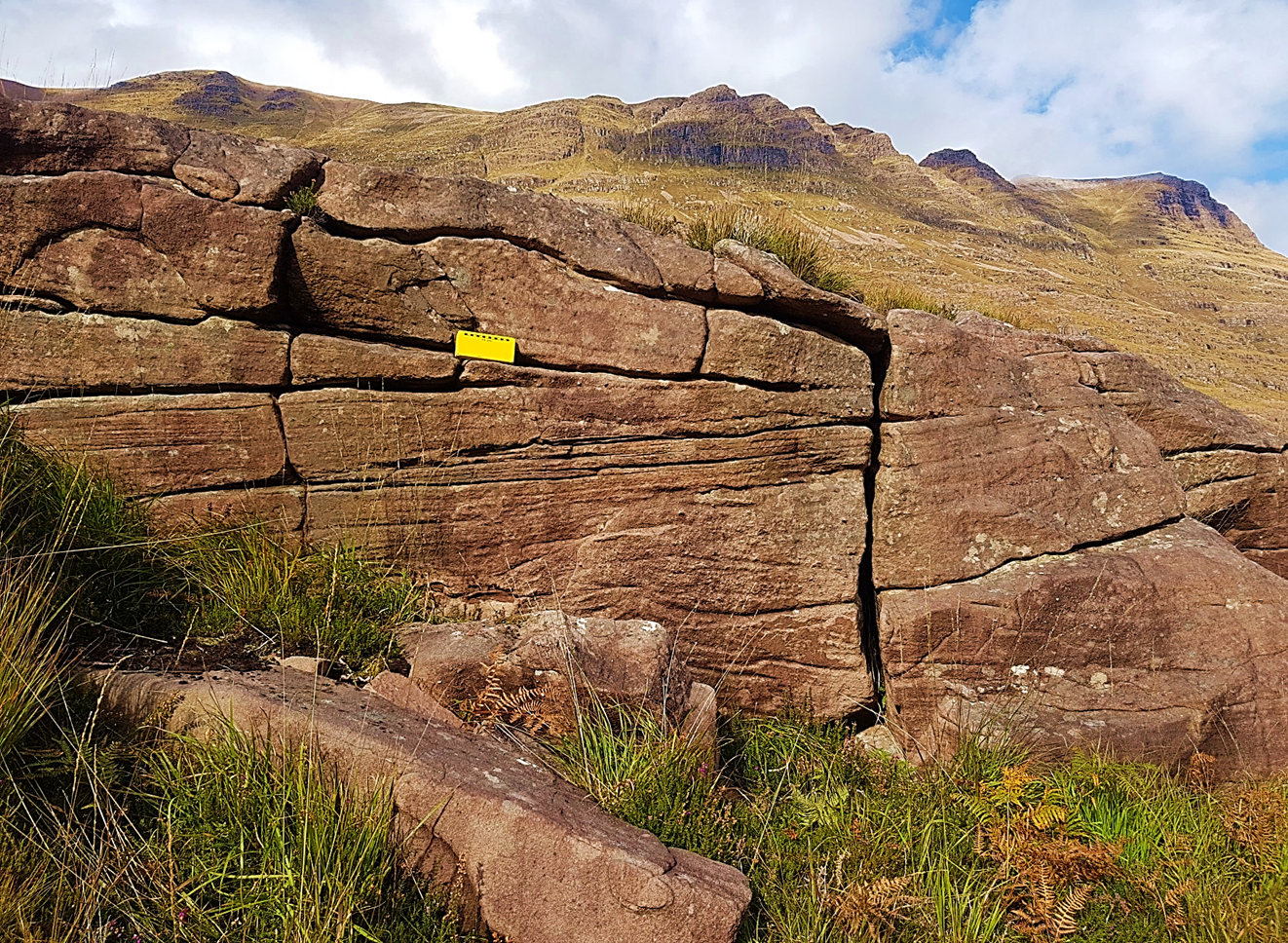
Billion year old fluvial stratigraphy in Scotland. What were rivers like before the evolution of plants?
The Earth’s landscape governs the distribution of food, water and resources for us all. The complex processes and behaviours shaping the Earth’s surface are dynamic and highly sensitive to climate and tectonic change, and we seek to reconstruct their past and project their future. This includes:
- Response of topography to climate and tectonics. We ask how faulting and climate controls topography on the planet and our research shows how we can use landscapes to quantify geohazards.
- Rates and magnitudes of erosion and sediment generation in mountainous catchments. We quantify how this process shapes landscapes and impacts society.
- Modelling landscape evolution. We model how terrestrial and submarine landscapes have evolved over time and we use these predictions to understand the impact of environmental change across the Earth.
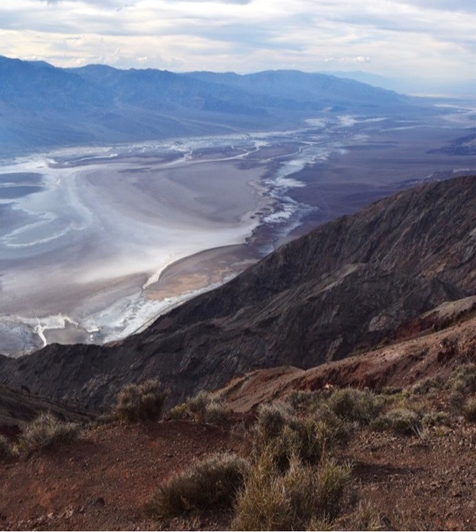
Death Valley after rain. We are interested in how extreme events such a this shape the surface of the Earth.
We tackle global energy challenges by advancing geoscience solutions for renewable energy development and subsurface storage. Our work focuses on creating next-generation AI technologies that can automatically interpret key geological features essential for wind-farm installation and other low-carbon infrastructure.
We also develop methods to enhance seismic imaging quality and integrate geological and geophysical datasets to enable efficient and reliable characterization and monitoring of subsurface storage sites for carbon capture and storage (CCS).
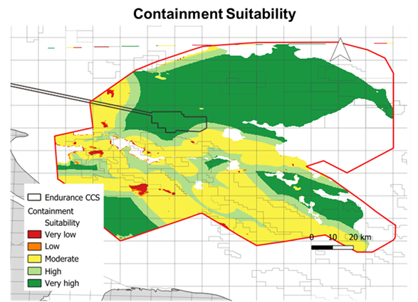
Models of injection and containment for carbon capture and storage (CCS) for the Southern North Sea
Our People
Dr Alexander Whittaker
/prod01/channel_3/media/images/people-list/alex%5B1%5D.png)
Dr Alexander Whittaker
Reader in Landscape Dynamics
Prof Gary Hampson
/prod01/channel_3/media/images/people-list/gary%5B1%5D.png)
Prof Gary Hampson
Professor of Sedimentary Geology
Dr Rebecca Bell
/prod01/channel_3/media/images/people-list/becky%5B1%5D.png)
Dr Rebecca Bell
Associate Professor in Tectonics
PhD students
- AL ALI, Alanoud
- BOZORGI, Fatemeh
- BUKAR, Idris
- COVENEY, Saoirse M.
- LOCHER, Valerie A.
- MCLEOD, Jonah S.
- MOHAMAD YUSOP, Farah
- REZWAN, Nahin
- SARIEDDINE, Karam
- WOOD, James
- WOODWARD, Amy
- YAN, Xiang
- ZHENG, Wenhao
- ZHOU, Ziqiang